The maps are as beautiful and detailed as any in a world atlas, with every river, town, and mountain painstakingly rendered and identified.
The only caveat? The places aren’t real. They only existed in the imagination of fantasy author J.R.R. Tolkien.
For decades, UW-Oshkosh geography professor Karen Wynn Fonstad was the world’s most prominent “fantasy cartographer.” She created the “Atlas of Middle-Earth” in 1981, painstakingly re-creating Mount Doom, Rivendell, and other locations from the “Lord of the Rings” world by drawing from descriptions in J.R.R. Tolkien’s many books.
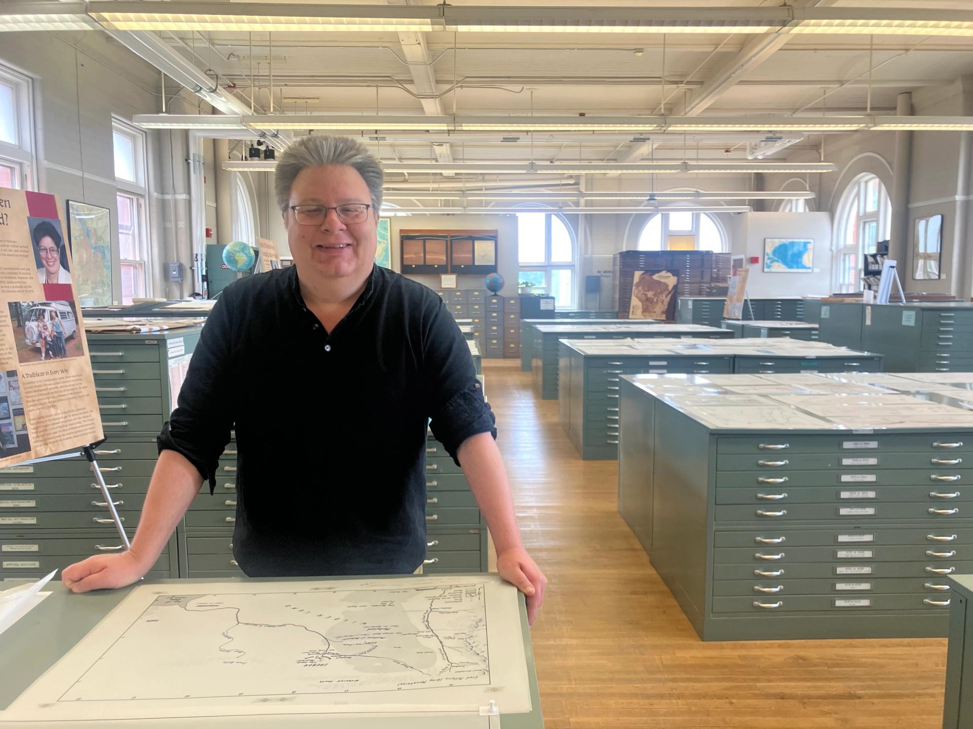
Before her death in 2005, she also made maps and atlases that charted the worlds of “Dungeons & Dragons,” “Dragonriders of Pern,” and other fantasy literature. Her son Mark Fonstad, a UW-Madison graduate and a geography professor himself at the University of Oregon, has curated a retrospective of his mother’s work, “Fantastic Worlds,” that will enthrall “Lord of the Rings” fans and mapmakers alike.
“Fantastic Worlds,” featuring dozens of Wynn Fonstad’s original hand-drawn maps, will be on display until Aug. 1 in the Robinson Map Library in Room 310 of UW Science Hall, and Mark Fonstad will host chats about his mother’s work on July 24 and July 30. He talked with Madison Minutes about his mother’s work.
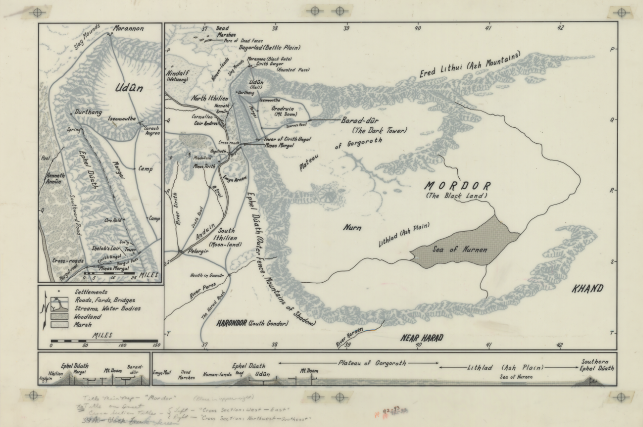
This map by Karen Wynn Fonstad details the land of Mordor. (Photo by Mark Fonstad)
Why do you think maps are such an important part of fantasy literature?
People who enjoy a particular fantasy story get invested in [it], and because it’s not a real place, they are putting themselves, their own minds into that. And anything that adds to that is great, because you can’t go visit it.
There’s a long tradition, even before Tolkien, of fantasy maps, sometimes called literary maps, that would actually go with the text. You find it in books hundreds of years ago, and now more than ever. You watch the introduction of “Game of Thrones,” and it’s a fantasy map.
How did your mother use Tolkien’s books to create the maps?
She would read them multiple times, and anything she found that would have some sort of geographical information she would underline. The few maps that Tolkien had done didn’t have a lot of detail, so most things that he talked about were not on his maps. So she had to basically do detective work.
He also had a knack in his books for incredible world-building detail, so there's far more detail than there is in most fantasy books. It’s clear that he had pictures in his head of places he had been, like in Germany, and he would imagine them, but on steroids.
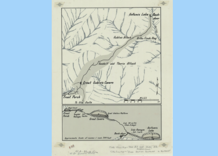
Karen Wynn Fonstad’s map of the caverns where Bilbo Baggins met Gollum in “The Hobbit.” (Photo by Mark Fonstad)
I know you’re hoping to find a permanent collection for your mother’s maps. Where have they been?
My mother was active cartographically from the late ‘70s through the early-to-mid ‘90s. After the atlases were finished, the maps we had were basically kept in my father’s closet. Which is actually a good place for them, because it’s dry and dark. And luckily, the material they’re on is this kind of mylar which is extremely stable. So they’re all in pretty good condition, with a few exceptions.
What would you like people to come away with after viewing your mother’s maps?
The biggest single thing is just to be immersed in these worlds that they’re interested in. It’s an opportunity that you don’t get other than to read her atlases. You can see the process of it, and we’ve put little stories into the exhibit of how she did things. And you can see how she changed through time. As she got more comfortable, there are ships and castles and cathedrals, even biological things.
The other thing is to show that it’s okay to be creative, even about something that might be viewed as escapist. It’s a very human thing. To map is human.